Library | Tag
Hannes Matt's Climate risk tools: Germany collection
Refine
75 results
REFINE
SHOW: 16

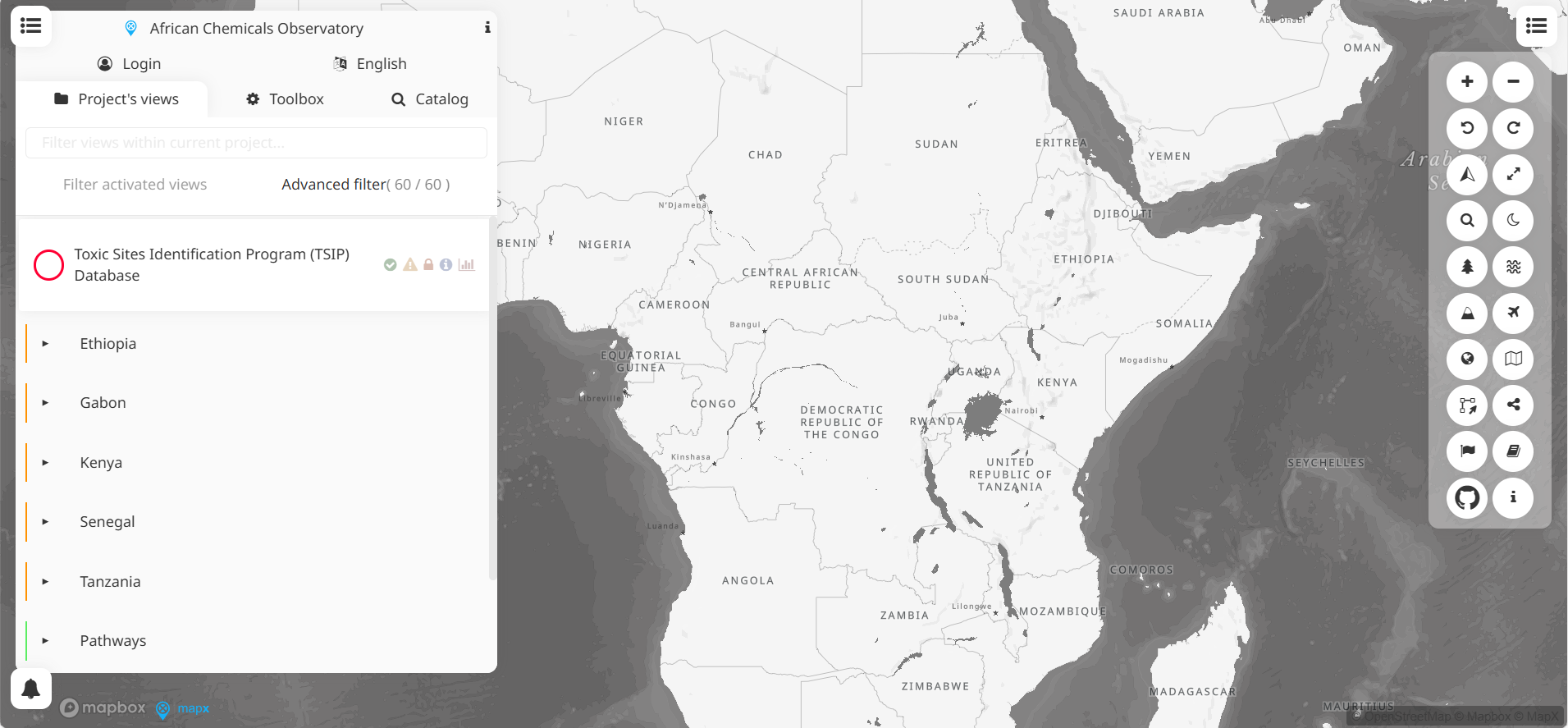
African chemical observatory
MapX is an open-source, cloud-based geospatial platform for visualising, analysing and managing environmental data. Developed by UNEP/GRID-Geneva, it supports decision-making in biodiversity, climate, land use and disaster risk, through map views, dashboards and storytelling tools.
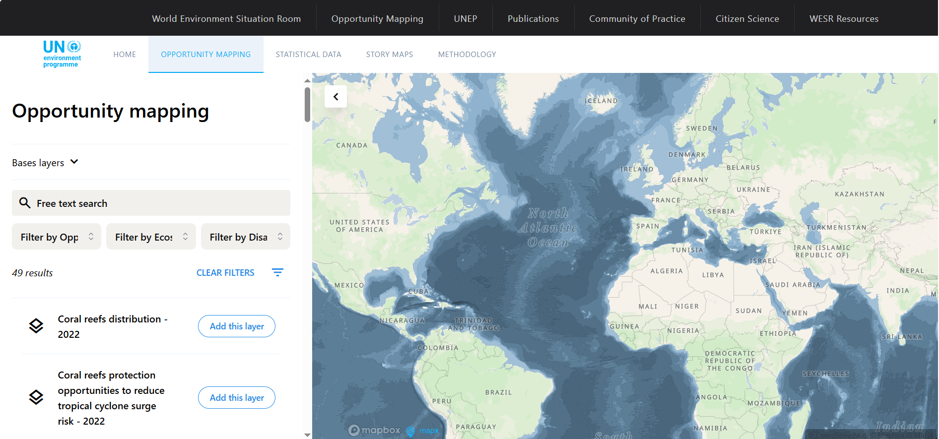
Opportunity mapping
The Opportunity Mapping tool by UNEP/GRID overlays global data on ecosystem distribution and human exposure to hazards, pinpointing areas where ecosystem protection or restoration may reduce disaster risk and protect the greatest number of people.
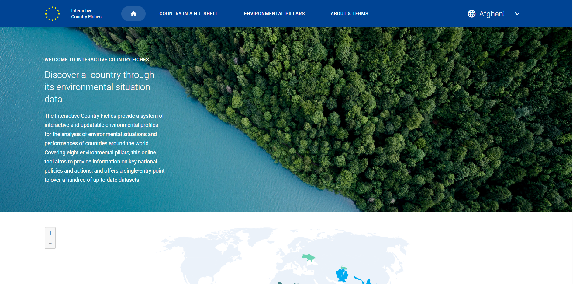
Interactive country fiches
The Interactive Country Fiches tool offers interactive, updatable environmental profiles for countries, covering eight environmental pillars. It centralises national policies, performance indicators and over 100 up-to-date datasets into a single access point.
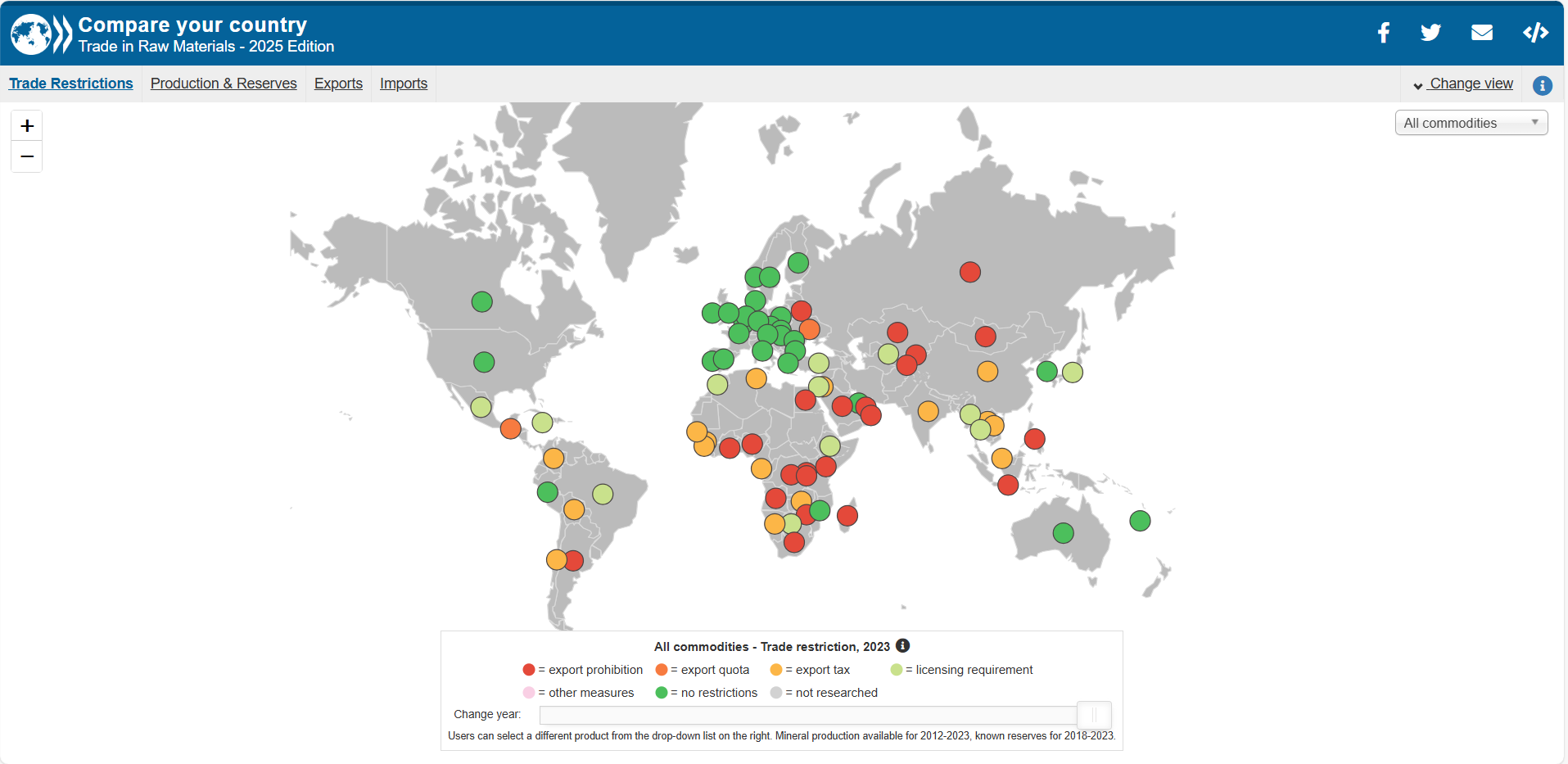
Compare your country: Trade in raw materials
This tool provides interactive visualisations and tabular data of country-level trade flows in raw materials (imports, exports, trends). It enables comparisons across years, commodities and nations, and cites metadata and definitions.
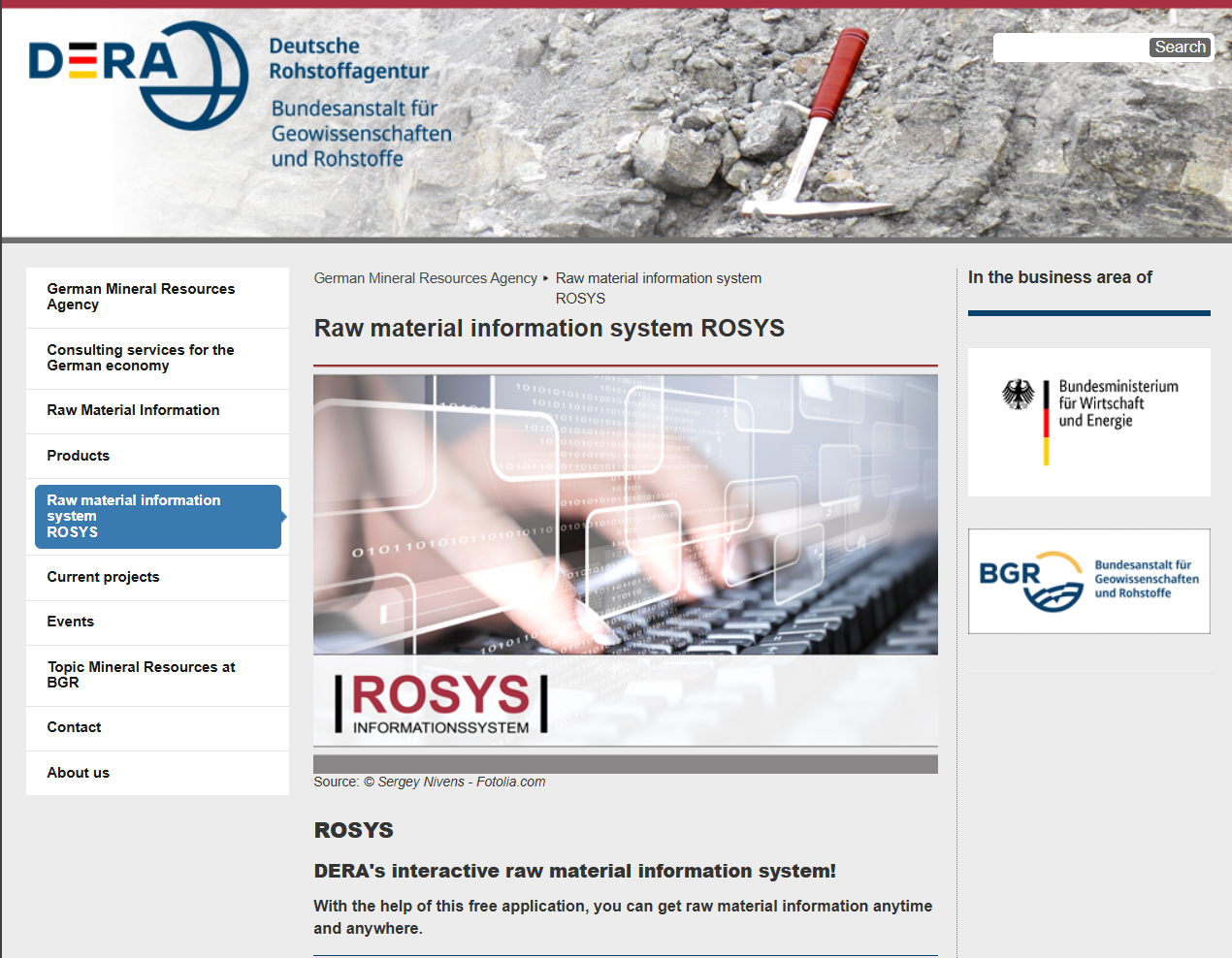
Rohstoffinformationssystem (ROSYS)
ROSYS is a free, interactive raw-materials information system from the German Mineral Resources Agency (DERA). It offers data on around 80 mineral and energy commodities, supported by maps and charts, enabling users to monitor global and German production, consumption, reserves, trade partners and market trends.
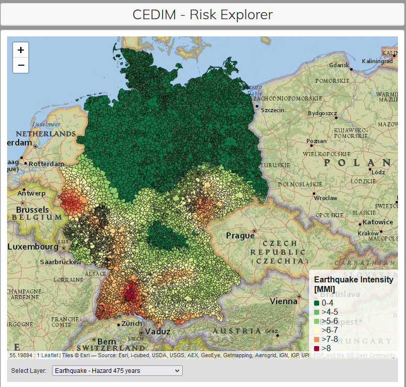
CEDIM Risk Explorer Germany
The CEDIM Risk Explorer Germany is a public, web‑based map viewer that enables interactive visualisation of hazard, vulnerability and risk across Germany—covering phenomena such as earthquakes, winter storms and (in Saxony) floods—for spatial risk assessment and expected monetary loss estimation.
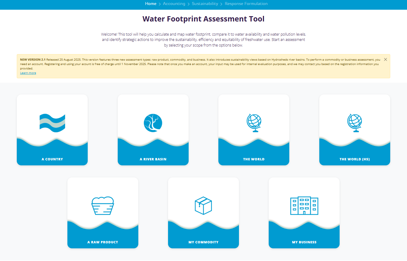
Water footprint assessment tool
The Water Footprint Assessment Tool is a free online application that enables businesses, governments, investors, NGOs and researchers to calculate and map green, blue and grey water footprints, assess sustainability, efficiency and equitable water use, and identify strategic actions to improve water management.
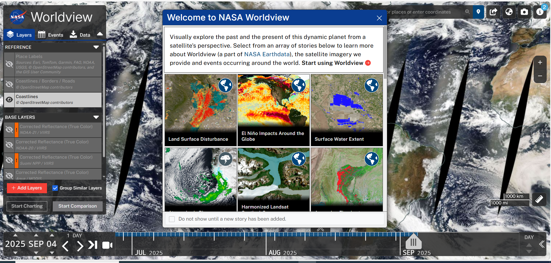
NASA world viewer
NASA’s Worldview is a web‑based visualisation tool offering interactive browsing, animation and download of over 1000 global satellite imagery layers, many available within three hours of observation. It supports time‑critical and historical analysis of natural hazards, climate phenomena and environmental change.
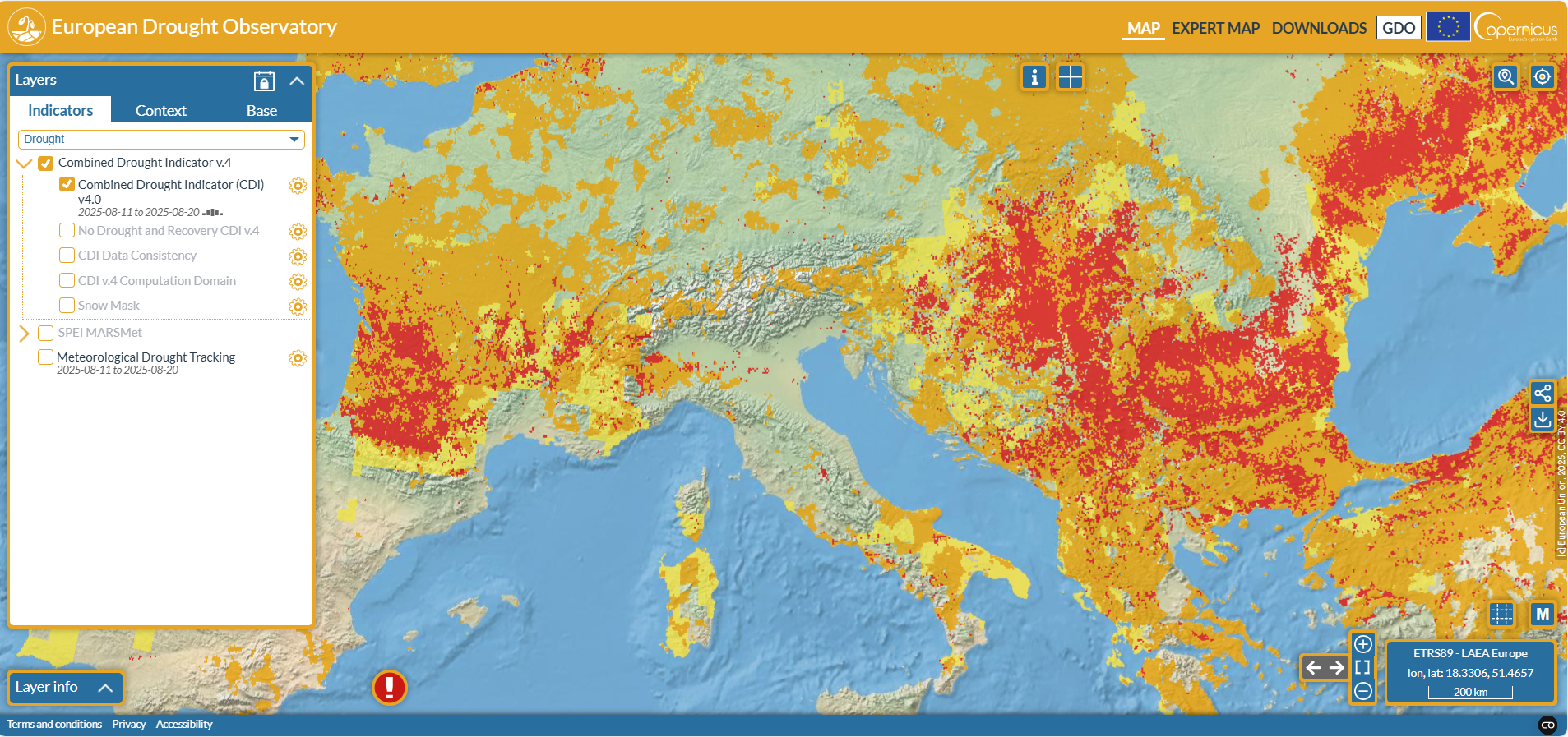
European drought observatory
Copernicus’ European Drought Observatory (EDO) mapviewer displays up‑to‑date drought indicators—such as soil moisture, low‑flow, precipitation and the Combined Drought Indicator—across Europe. Users can access, view and download data freely, though caution is advised interpreting some hydrological outputs east of Poland since mid‑May 2025.

Local sea-level projections
This tool shows local sea-level projections (relative to 2000) using tide-gauge and gridded data from Kopp et al (2014), extended by Rasmussen et al (2018) and Bamber et al (2019). It provides scenarios labelled RCP26, RCP45 and RCP85, with uncertainty ranges and attention to regional differences.
Indicators for the Kunming – Montreal Global Biodiversity Framework
This site provides information about the proposed indicators for the monitoring framework for the Post 2020 GBF.