Library | Asset Class
Infrastructure
Investments in essential physical systems and facilities (transport, energy, water, communications) that support economic and social activity.
Refine
335 results
REFINE
SHOW: 16


Sustainable Finance Roundup March 2026: Markets, Climate Risk, and the Transition in Practice
This month’s sustainability roundup captures a shift from framework development to real-world application, where climate and nature risks are increasingly embedded across financial systems, legal accountability, and decision-making. It highlights how intensifying physical climate signals, evolving disclosures, and maturing litigation are converging with insights on sovereign risk, energy systems, and corporate strategy. Together, these developments show how sustainability is moving beyond principle—being tested, priced, and enforced across markets, regulation, and the real economy.

You Built This
This article argues that modern investment strategies fuel economic extraction while often underperforming simpler alternatives. It calls on investors to realign portfolios with productive, community-oriented investments that generate real economic and social value.

Market assessment on critical minerals innovation in developing countries
This report assesses critical minerals innovation in developing countries, focusing on midstream processing and downstream manufacturing, recycling and end-of-life treatment. It reviews 30 countries, highlights policy and financing gaps, and recommends stronger infrastructure, coordination, technology transfer and support for innovation ecosystems.
Australian financial institutions’ views on climate and clean energy opportunities in South and Southeast Asia
Assesses Australian financial institutions’ views on climate and clean energy investment in South and Southeast Asia, highlighting growth potential, limited current exposure, key risks, and barriers. It emphasises blended finance, policy support, and government intervention to mobilise private capital and scale regional investment.
Sustainable Finance Roundup February 2026: Disclosure, Carbon Trade, and Transition Economics
This month’s sustainability roundup traces a rapidly evolving landscape in climate governance and industrial transition, highlighting the convergence of ISSB-aligned disclosure standards and emerging carbon trade measures alongside shifting cost curves in transport and critical minerals. It underscores how tighter emissions accounting and border policies are embedding carbon competitiveness into capital allocation, while advances in electrification, AI-driven power demand and expanding legal accountability are integrating climate and nature risk into mainstream financial decision-making.
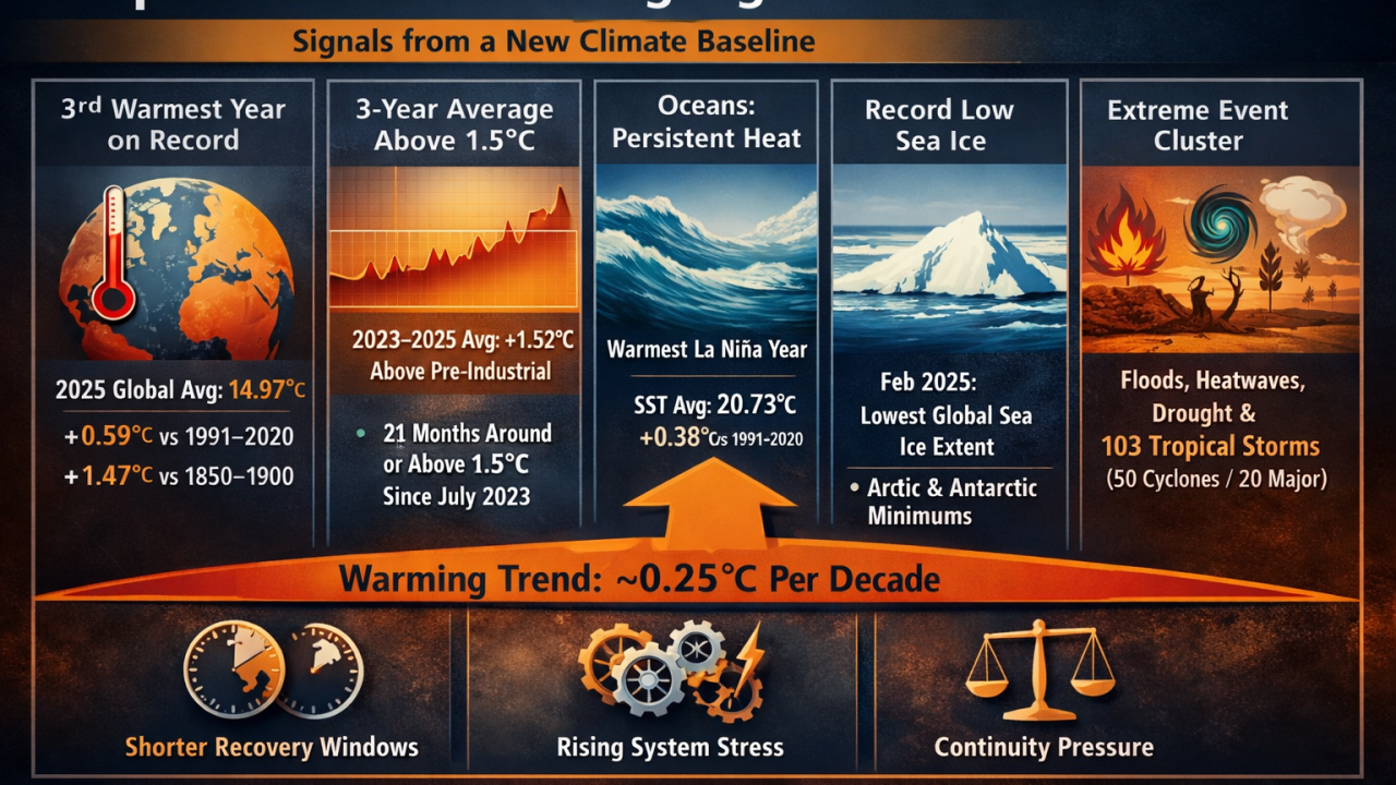
PerilScope: Strategic Deep Dive Copernicus Global Climate Highlights 2025 — From Records to Operating Conditions in the 3°C World SRP® Frame
The article interprets Copernicus’s Global Climate Highlights 2025 as a shift from episodic extremes to a structurally warmer, more volatile baseline. It argues that persistent temperature exceedances, ocean heat, cryosphere decline, and overlapping hazards demand a move from climate risk awareness to disciplined adaptation and continuity planning.
Nature-based risk assessment: Integrating project-related finance
Guidance from UNEP FI and the Equator Principles on integrating project-related finance into nature-based risk assessments. It outlines frameworks, governance and disclosure expectations to help financial institutions identify, assess and manage biodiversity, water and pollution-related risks at project and portfolio levels.

Future energy scenarios: Pathways to Net Zero
Future Energy Scenarios 2025 provides independent pathways for Great Britain’s energy system to reach net zero by 2050. It models demand, supply, flexibility and emissions across electricity, gas and hydrogen, assessing costs, infrastructure needs, carbon budgets and policy choices under varying levels of electrification, hydrogen deployment and consumer engagement.
Frozen gas, boiling planet: How bank and investor support for LNG is fueling a climate disaster
The report analyses bank and investor financing of LNG expansion, finding US$213 billion in bank support and US$252 billion in investor exposure since 2021. It concludes this financing drives overcapacity, climate risk and misalignment with 1.5 °C pathways.

Energy and AI
The IEA’s Energy and AI report examines AI’s rising electricity demand and its capacity to improve energy efficiency, security and innovation. It assesses data centres, grids and end-uses, highlighting skills, infrastructure and policy needs to manage costs, emissions and resilience globally.

We can’t ignore the largest source of methane
This article argues the global food system is the largest source of human-caused methane and deserves far more policy and funding attention. It maps key emission “hot spots”—ruminant livestock, food waste in landfills, biomass burning, and flooded rice fields—and outlines practical mitigation options from dietary shifts to landfill capture and improved rice management.
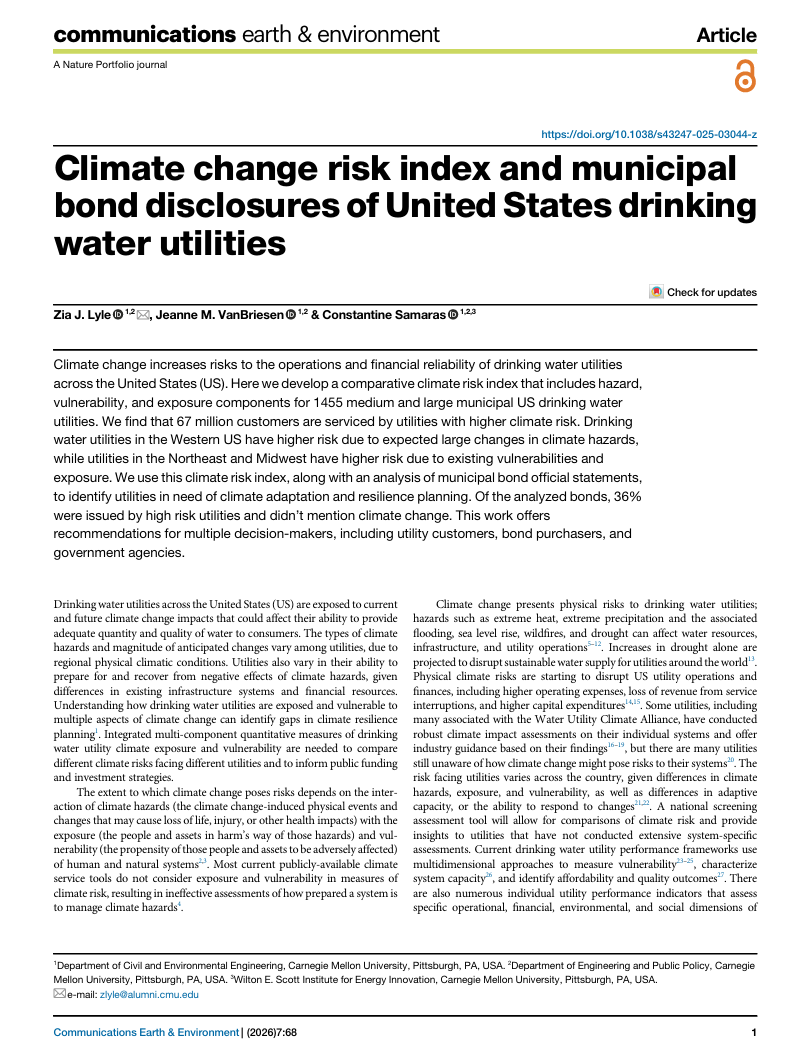
Climate change risk index and municipal bond disclosures of United States drinking water utilities
This study develops a climate risk index for 1,455 US municipal drinking water utilities and compares projected risks with municipal bond disclosures. It finds material mismatches between climate risk and disclosure, highlighting utilities where climate adaptation and financial risk management may be insufficient.
Mobilising investment for climate adaptation
This report assesses Australia’s escalating climate risks and argues for scaling adaptation investment. It recommends improved valuation methods, a nationally coordinated adaptation investment framework, and diversified public-private financing mechanisms to reduce long-term economic damage and enhance resilience.
Climate and catastrophe insight series
The Climate and Catastrophe Insight is an annual research series that provides a consistent global view of natural disaster activity and climate-related catastrophe trends. It examines impacts on people, assets and economies to support risk assessment, resilience planning and long-term decision-making.
Sustainable Finance Roundup January 2026: Geopolitics, Energy Transitions, and Systemic Risk
This month’s sustainable finance article roundup examines a landscape increasingly shaped by geopolitics and climate risk, as near-term fragmentation, energy security, and affordability pressures collide with intensifying long-term threats from climate change, biodiversity loss, and water stress. The works featured analyse how these dynamics are reshaping capital allocation, disclosure, and resilience planning, demonstrating the growing need for sustainable finance to integrate geopolitical risk with real-economy transition.
Global landscape of climate finance series
Global Landscape of Climate Finance is a recurring benchmark series produced by Climate Policy Initiative that provides a consistent overview of global climate finance flows. It examines sources, instruments, uses, and geographic distribution of finance to track progress and comparability across years.