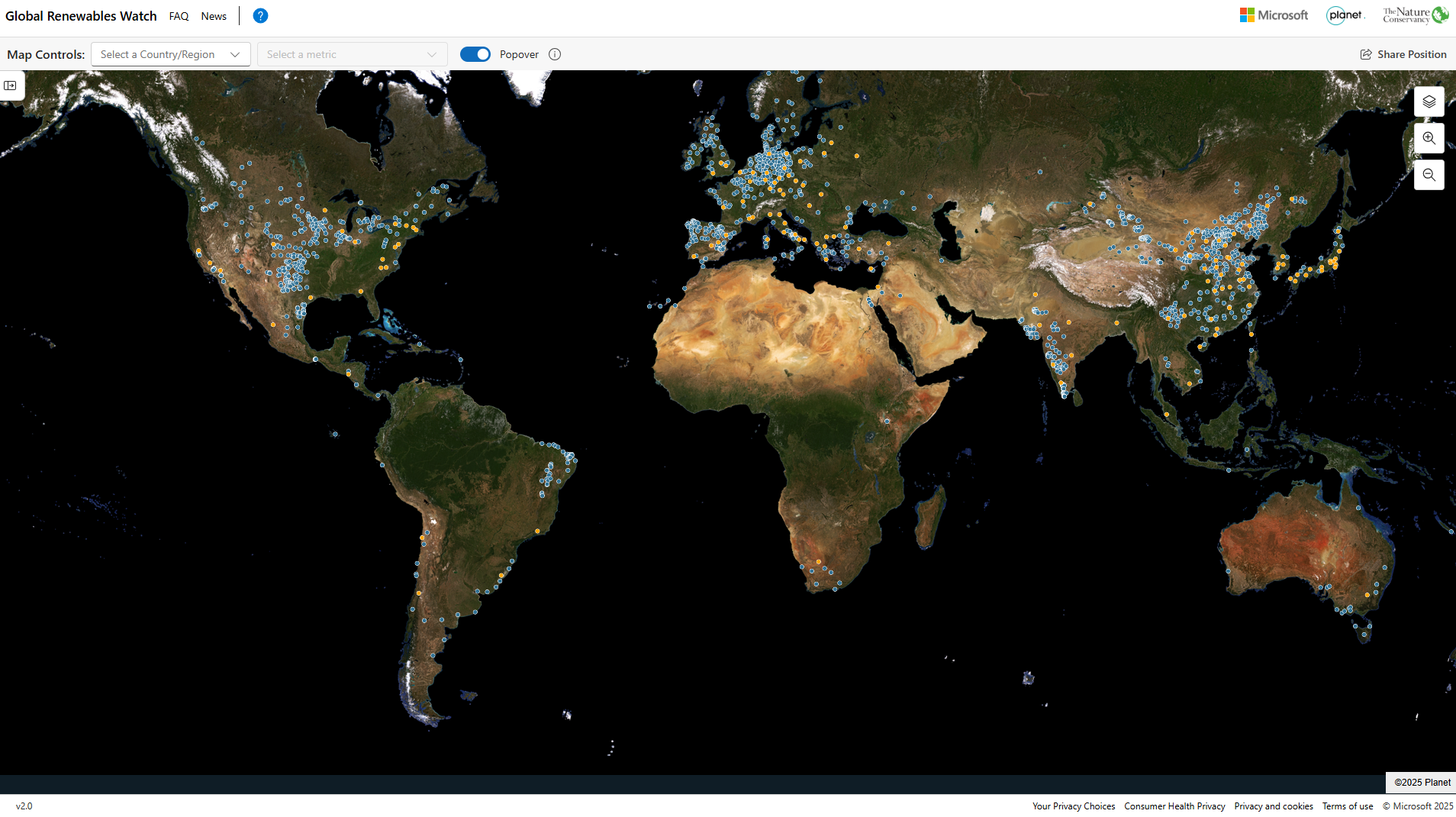
Global Renewables Watch Atlas is an interactive, map-based platform that tracks global utility-scale solar and wind infrastructure using satellite imagery and artificial intelligence. It enables users to monitor deployment trends and estimate capacity over time. The tool is relevant to finance professionals for analysing energy transition progress and infrastructure distribution globally.
Organisation behind the tool
The tool is developed through a partnership between Microsoft, Planet Labs and The Nature Conservancy. Microsoft provides AI and cloud capabilities, Planet Labs supplies high-resolution satellite imagery, and The Nature Conservancy contributes environmental expertise and analysis.
What the tool does
- Maps utility-scale solar photovoltaic and onshore wind installations globally using satellite imagery and AI.
- Provides a continuously updated (“living”) atlas to track renewable energy deployment over time.
- Enables users to estimate installed capacity and monitor growth trends at global and country levels.
- Offers geospatial datasets including installation locations, construction timing and prior land use.
- Supports data access for analysis, including downloadable datasets for further modelling and research.
Target audience
The primary users are policymakers, researchers and environmental organisations assessing renewable energy deployment. The tool is also relevant to analysts, development institutions and the general public interested in energy transition data.
Relevance to finance professionals
- Risk assessment – Identify geographic concentration of energy infrastructure and potential exposure to physical or regulatory risks.
- ESG analysis – Evaluate renewable energy expansion as part of climate and energy transition metrics.
- Market insights – Track global and regional trends in solar and wind deployment to inform sector outlooks.
- Investment context – Assess progress towards net zero targets and identify areas of growth or underinvestment in renewable infrastructure.