Climate Mapping for Resilience and Adaptation (CMRA) is a web-based geospatial screening tool that integrates federal climate and non-climate data. It helps users assess local exposure to past, present and projected climate hazards such as extreme heat, drought and flooding. Finance professionals may find it relevant for environmental risk assessment and asset planning under climate change scenarios.
Organisation behind the tool
CMRA is developed and hosted by the US National Oceanic and Atmospheric Administration (NOAA), with contributions from multiple US federal agencies and partners. The project was built in collaboration with Esri under contract to NOAA, and includes guidance from the Federal Geographic Data Committee. The Department of the Interior and other agencies contribute data and support.
What the tool does
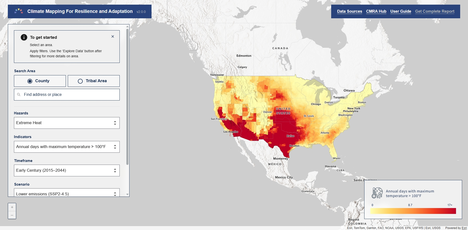
- Provides interactive maps showing current and future exposure to key climate hazards (e.g. extreme heat, drought, wildfire, flooding, coastal inundation).
- Offers an Assessment Tool that generates statistics, charts and downloadable reports for specified geographies (e.g. counties, census tracts).
- Aggregates and displays historical observations and future projections of climate conditions.
- Curates federal datasets ready for use in mapping and analysis (CSV, GeoJSON, GeoTIFF, etc).
- Lists federal funding programmes linked to resilience and adaptation planning.
Target audience
Primary users include government planners and analysts at local, state, tribal and federal levels, and community resilience practitioners. The tool also serves researchers, NGOs, and concerned citizens seeking data on climate hazards and exposure.
Relevance to finance professionals
- Risk assessment – Assess exposure of assets and infrastructure to climate-related hazards now and under future scenarios.
- ESG analysis – Source factual climate hazard data for environmental risk disclosures and sustainability reporting.
- Market/commodity insights – Understand geographic climate stressors relevant to sectors such as agriculture, energy and water resources.
- Investment context – Inform long-term investment decisions and infrastructure planning by analysing projected climate conditions and potential impacts.