About | Ishita Rai
Ishita Rai
I summarise and categorise all resources that go into Altiorem’s library, support engagement with Altiorem members, and ad hoc projects that enhance Altiorem’s value proposition and offering to sustainable finance communities.
PROFILE
I summarise and categorise all resources that go into Altiorem’s library, support engagement with Altiorem members, and ad hoc projects that enhance Altiorem’s value proposition and offering to sustainable finance communities.

RECENTLY PUBLISHED BY ISHITA RAI
The Climateworks guide to credibility for corporate climate transition plans
Provides an Australian-focused framework for assessing the credibility of corporate climate transition plans, outlining principles, criteria and disclosure expectations. It supports companies, investors and regulators in evaluating emissions targets, governance, strategy alignment and risk management within mandatory climate reporting and net zero transition planning.

Climateworks Centre
Climateworks Centre is an independent non-profit climate research organisation based at Monash University. It develops evidence-based solutions to support net zero emissions across Australia, Southeast Asia and the Pacific, advising governments, businesses and investors on decarbonisation, sustainable finance, and climate transition strategies.
Governing for net zero: The board's role in organisational transition planning
This report guides Australian boards on integrating net zero transition planning into strategy, governance, disclosure and stakeholder engagement. It outlines directors’ legal duties, mandatory climate reporting requirements, and practical oversight questions to help organisations manage climate-related risks, opportunities and implementation.
Guidance for applying absolute environmental sustainability assessment on activities at different scales (BETA version)
Provides beta guidance for applying Absolute Environmental Sustainability Assessment, comparing activities’ environmental burdens against planetary boundaries. It outlines a three-phase, nine-step framework, supported by case studies (buildings, cement, EU consumption), and aligns with existing accounting standards while addressing methodological gaps in allocating environmental limits.
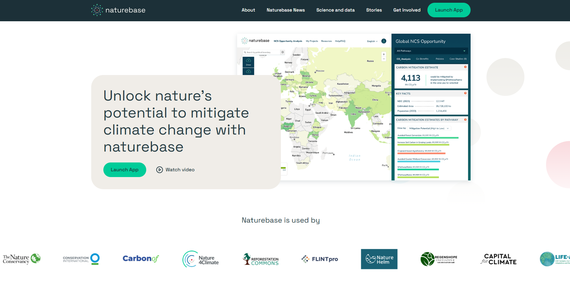
Naturebase
Naturebase is a free, science-based platform that maps where and how to implement nature-based solutions. It provides data on carbon mitigation potential, biodiversity and social benefits, alongside policy guidance and case studies, enabling investors and policymakers to identify, assess and finance high-integrity climate and nature projects.
Attribution of extreme events to climate change in the Australian region
This report reviews how reliably climate change can be linked to extreme events in Australia, finding strongest attribution for heat-related events, moderate confidence for some rainfall and drought, and limited capability for storms, east coast lows and multi-year droughts, while outlining research priorities to improve attribution.
Working with uncertainty in climate planning and adaptation
Explains how uncertainty in climate models affects adaptation planning, highlighting assumptions, variability, model limitations and downscaling challenges. Emphasises using scenarios and probability approaches to inform decisions, while recognising incomplete knowledge and the need for cautious, context-specific interpretation of projections.

University of New South Wales (UNSW Sydney)
University of New South Wales (UNSW) is a leading Australian public research university based in Sydney, offering undergraduate and postgraduate degrees across disciplines including business, engineering and law. UNSW focuses on innovative research, sustainability and global partnerships, supporting industry engagement and delivering education that improves societal outcomes locally and internationally.
Heightened human rights due diligence
UNDP’s training guide explains heightened human rights due diligence for companies in conflict-affected contexts, outlining frameworks, legal expectations and practical steps to assess, mitigate and remedy impacts on human rights and conflict, supported by case studies and tools to guide implementation.
Global literature review and survey of implementation constraints on natural climate solutions
Global review and project survey of natural climate solutions across 137 countries finds implementation is constrained mainly by social-behavioural, knowledge, and government or organisational barriers, especially weak policy coordination and implementation capacity. Without targeted enabling measures, near-term mitigation will remain below biophysical potential.
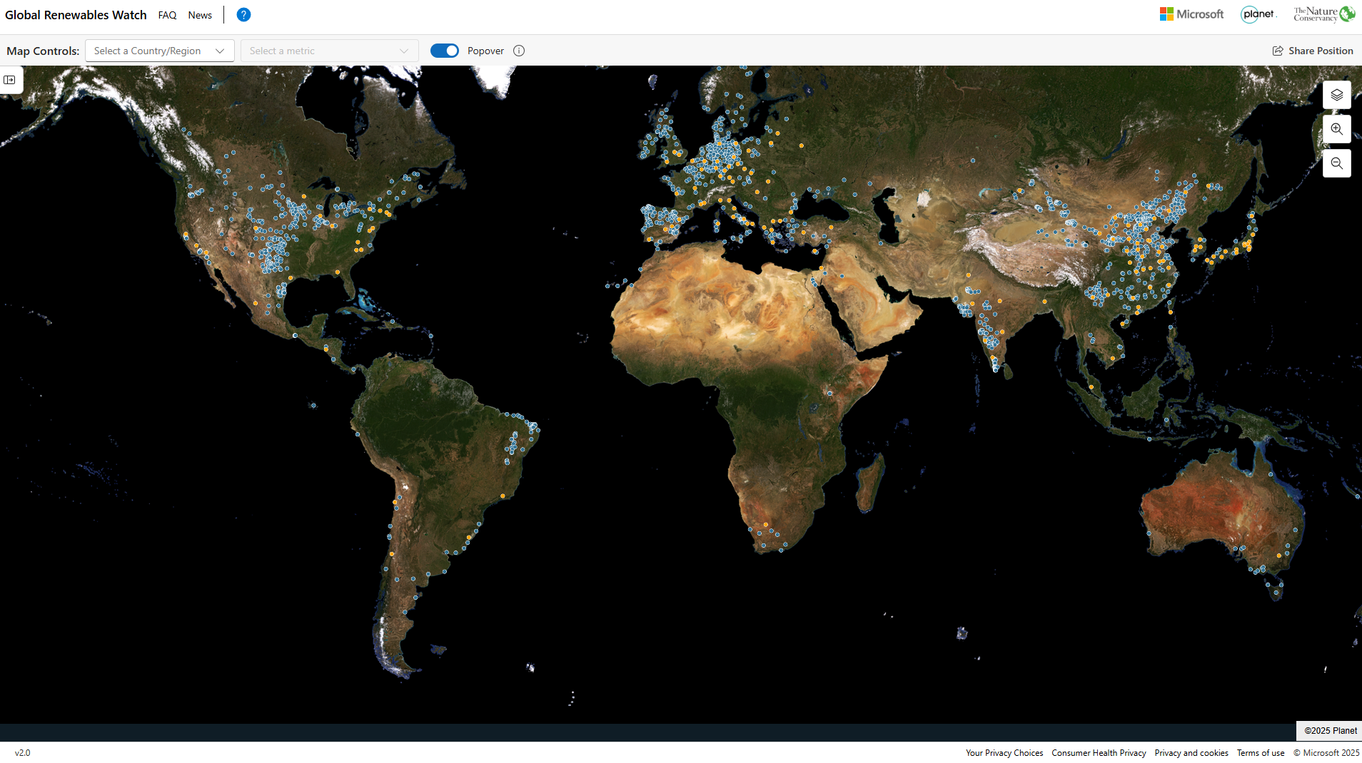
Global Renewables Watch
Global Renewables Watch Atlas is an interactive platform mapping utility-scale solar and wind installations worldwide using AI and satellite imagery. It provides regularly updated geospatial data to track deployment trends, estimate capacity, and assess progress in the energy transition, supporting analysis by policymakers, researchers, and finance professionals.

The Nature Conservancy
The Nature Conservancy (TNC) is a global environmental non-profit organisation focused on conserving lands, waters and biodiversity. It uses science-based conservation, partnerships and sustainable finance approaches to address climate change and habitat loss, supporting nature-based solutions that benefit ecosystems, communities and long-term environmental resilience worldwide.
Planet Labs
Planet is a space technology company providing Earth observation data through a large fleet of satellites. It delivers high-resolution satellite imagery and geospatial analytics to monitor environmental change, agriculture and infrastructure. Its platform supports decision-making across climate, finance and government sectors using near-daily global imaging insights.

Microsoft
Microsoft Corporation is a global technology company delivering software, cloud computing, artificial intelligence, and hardware solutions. Its products include Windows, Microsoft 365, Azure, and Xbox. Serving businesses and consumers worldwide, Microsoft supports digital transformation, productivity, and enterprise services through integrated platforms, developer tools, and secure cloud-based technologies.
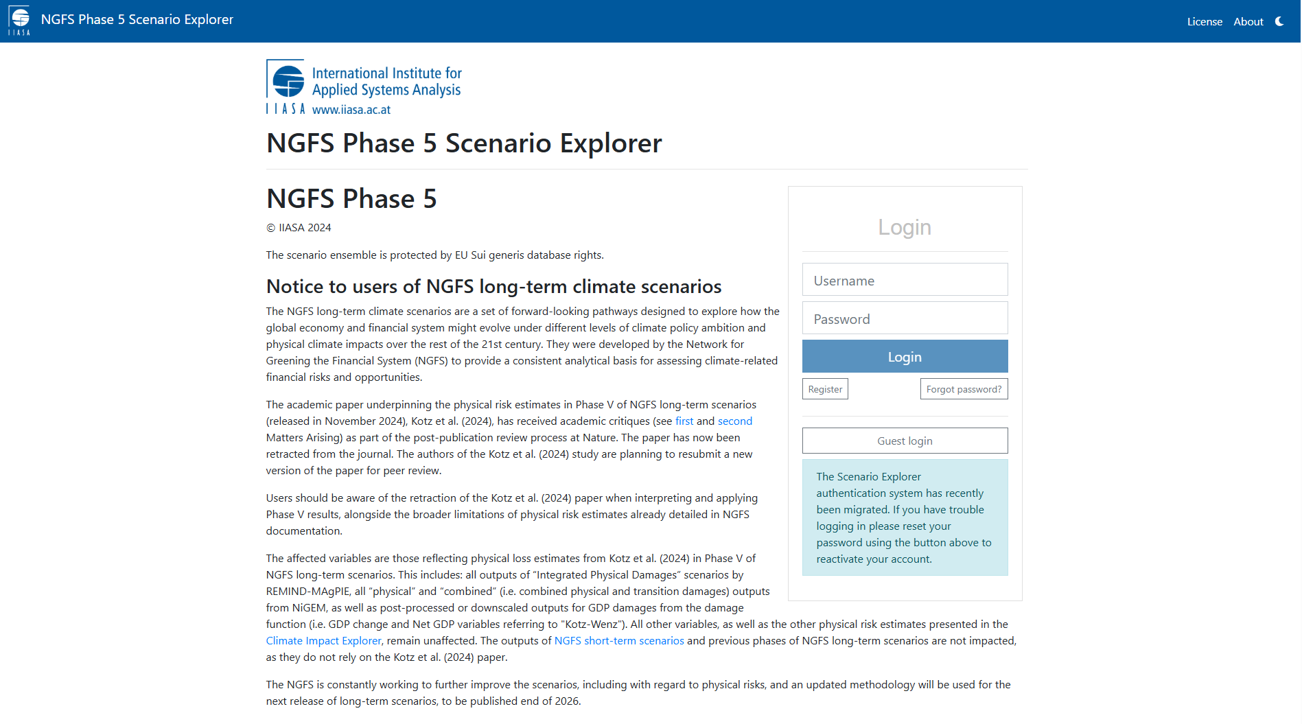
NGFS Phase 5 Scenario Explorer
Web-based platform by NGFS and IIASA providing access to climate scenario data. It enables users to visualise, compare and download time-series data on transition pathways, physical risks and macroeconomic impacts, supporting climate risk analysis, stress testing and financial modelling. Data can be accessed via workspaces, bulk downloads or APIs.
University of Maryland
University of Maryland (UMD) is a leading public research university in the United States, known for academic excellence, innovation and interdisciplinary research. Based in College Park, UMD offers diverse degree programmes and collaborates with government and industry to address global challenges in science, technology, public policy and sustainability.