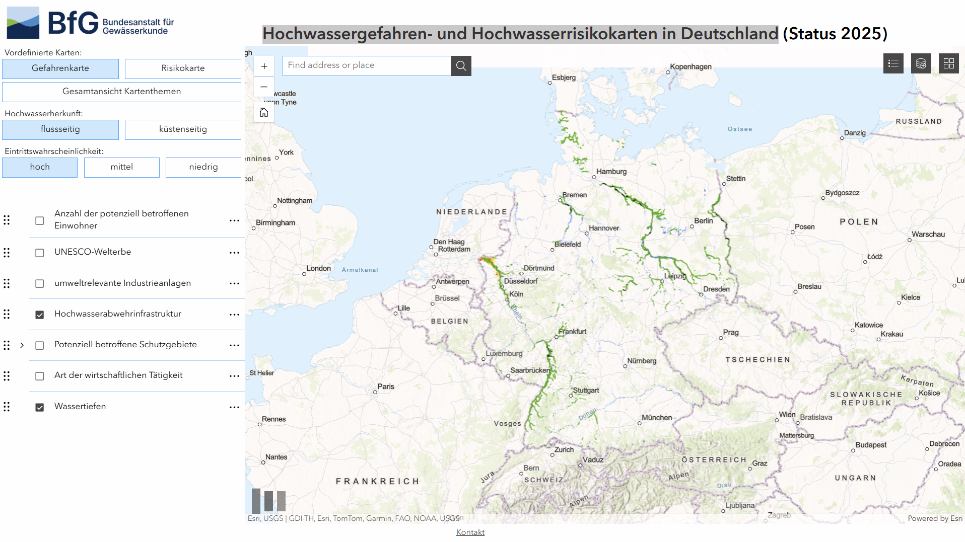
Overview
This tool is an online geoportal providing up-to-date flood hazard and flood risk information for Germany. It supports spatial analysis of flood probability, extent and potential impacts under the EU Floods Directive. Finance professionals may find it relevant for assessing physical climate risks and location-specific exposure to flooding.
Organisation behind the tool
The tool is developed and maintained by Bundesanstalt für Gewässerkunde (BfG), Germany’s Federal Institute of Hydrology. It aggregates and presents flood risk management data produced by federal states and responsible water authorities within the EU Floods Directive framework.
What the tool does
- Displays current flood hazard and flood risk maps for Germany
- Shows flood scenarios by probability (e.g. frequent, medium, extreme events)
- Visualises flood extent, water depth and affected areas
- Includes risk layers related to population, economic activity, infrastructure and protected sites
- Allows map-based exploration and comparison across regions
- Provides contextual information aligned with Flood Risk Management Plans
Target audience
The primary users are public authorities, planners and water management professionals. Other audiences include researchers, insurers, infrastructure operators, consultants and members of the public seeking authoritative flood risk information.
Relevance to finance professionals
- Risk assessment – identify geographic exposure of assets, infrastructure and supply chains to flood hazards
- ESG analysis – support environmental risk disclosures related to climate adaptation and physical risk
- Market and infrastructure insights – inform assessments of transport, real estate, utilities and industrial sites in flood-prone areas
- Investment context – contribute to long-term analysis of climate-related risks affecting asset valuation and resilience