3D geological modelling of the Riddarhyttan Ore Field (Fe-Cu-Au-Co-Mo-REE)
This report details 3D geological modelling of the Riddarhyttan Ore Field, identifying significant iron, copper, and rare earth element mineralisations. Characterising complex deformation patterns, the research suggests orebodies extend below historical mining depths, indicating high potential for future resource extraction within the western Bergslagen region.
Please login or join for free to read more.

OVERVIEW
Introduction
The Geological Survey of Sweden (SGU) has developed 3D geological models for the Riddarhyttan Ore Field, situated in western Bergslagen. The region is notable for iron-oxides and metals such as copper, gold, cobalt, molybdenum, and rare earth elements (REE), most of which are classified as critical by the European Union. The modelling aimed to provide insights into the lateral and vertical continuation of mineralisations to assist future exploration and infrastructure projects. Local deposit-scale models and a regional framework model were constructed using Leapfrog Geo software.
Geological setting
The field lies on the REE line, a belt over 100 kilometres long. It comprises metavolcanic rocks with intercalated marble and banded iron formation (BIF) formed between 1.92 and 1.88 Ga. The sequence underwent polyphase deformation during the Svecokarelian orogeny, resulting in a high-strain zone known as the West Bergslagen Boundary Zone. Strong hydrothermal magnesium alteration and high-grade metamorphism have largely obscured primary structures and stratigraphy in the area.
Mining history, exploration and mapping activities
Mining in the area dates back to at least 1420. Between 1731 and 1979, total production was estimated at 15 Mt of iron ore and 0.12 Mt of copper ore. Bäckegruvan remained active until 1979. Recent exploration includes campaigns by EMX Royalty in 2018–2019, which involved a high-resolution VTEM survey and 5.5 kilometres of drilling across 15 deep holes to generate targets for further observation.
Methodology and modelled volumes
Models were generated from geological maps, structural measurements, drill data, and mine maps. Deposit-scale models primarily utilised the “Vein modelling” tool with FastRBF interpolation. Regional models reached depths of 3.0 kilometres, while deposit models typically measured 500 to 750 metres. The regional model consists of multiple fault blocks and folding patterns interpolated from strike-dip measurements obtained from outcrops and drill cores.
Model input data
Data included 336 drillholes with a total length exceeding 43 kilometres, 391 new gravity measurements, and airborne geophysical surveys providing magnetic, electromagnetic, and spectrometric information. Structural data was collected from outcrops, including 198 foliation measurements. Lineaments interpreted from magnetic and resistivity maps formed the basis for a new fault map, identifying NNE to NE-striking faults predominant in the sedimentary-volcanic domain.
Modelling results
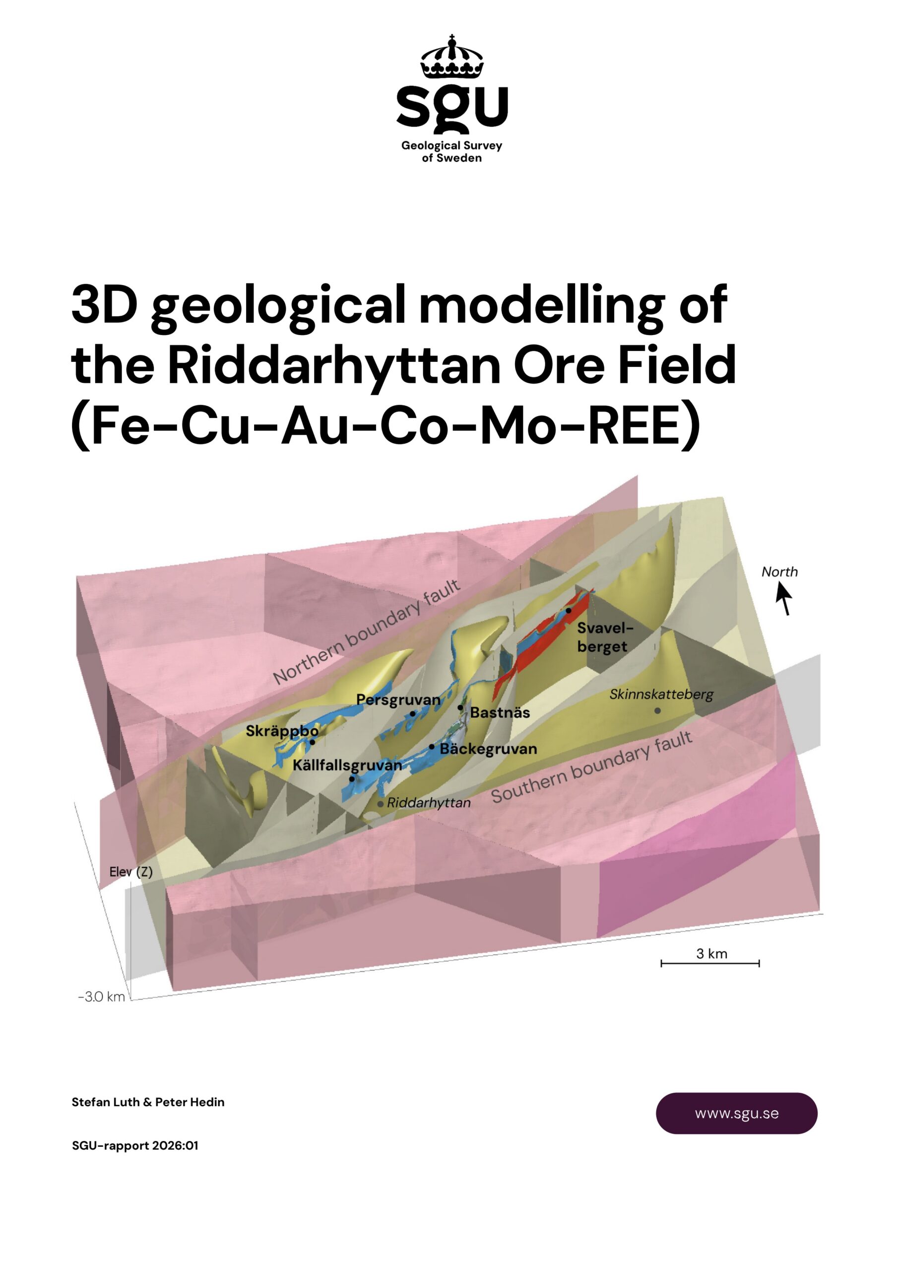
The Korphyttefältet–Bastnäs model is characterised as a refolded fold dismembered by a NE-striking shear zone. Persgruvan–Lerklockan orebodies occur as parallel lenses or megaboudins dipping northwest, while Pellegruvan–Bäckegruvan–Östergruvan comprises an anastomosing network of eight magnetite layers. Källfallsgruvan exhibits an S-shaped, steeply plunging synform. Svavelberget reveals three NE-striking sulphide vein segments truncated by a vertical fault, and Skräppbo is modelled as a doubly plunging synform.
Interpretation and discussion
A new structural-geological map indicates F2 folds with fold-axes plunging 40° to 70° towards the southwest. The presence of large, sub-parallel synforms and antiforms suggests sheath folding or re-folding along NW–SE trending F3 axial traces. A fault duplex structure, indicated by the overall asymmetry of the blocks, suggests predominantly dextral shearing during D2 transpression.
Conceptual kinematic model
A three-phase deformation model is proposed to explain the structural evolution. Phase D2 involved E–W transpression with dextral shearing and the formation of drag folds. Phase D3 saw a shift to N–S transpression and sinistral shearing, which refolded earlier structures. Phase D4 involved primarily brittle N–S shortening, resulting in the formation of conjugate fault sets and block rotation.
Ore genetic model
The mineralisations likely formed from hot hydrothermal fluids of magmatic origin reacting with carbonate layers in a shallow marine back-arc basin. Local fluid pathways developed along syn-sedimentary normal faults and lithological contacts. Distal mineralisations formed as fluids migrated horizontally along volcanite-limestone boundaries from feeder zones like Bastnäs and Bäckegruvan, which were likely connected to major faults.
A future resource?
Historic estimates suggested remaining tonnage of 7.5 Mt at Bäckegruvan and 2.8 Mt at Persgruvan. SGU’s 2020 analysis indicates the field potentially contains 25 million tonnes of ore and 7.45 million tonnes of tailings with elevated copper, cobalt, molybdenum, and REE. Bäckegruvan drill cores yielded up to 1.68% REE, while gold concentrations below Pellegruvan reached 0.75 g/t.
Conclusions
Modelling suggests most orebodies continue below current mined levels, with magnetite skarns potentially exceeding 1,000 metres depth. The study concludes that folding and faulting repeatedly expose the same mineralised horizon throughout the area. It is recommended that these models be used for targeting and resource estimation only after incorporating additional input from site investigations and seismic modelling.