Freshwater ecosystem explorer
FreshExplorer is an interactive mapping tool that displays data on water, sanitation, and hygiene services globally, assisting policymakers and researchers to view coverage statistics, trends, and service gaps. The platform enables data exploration by country, service type, and time period, using Aus/UK spelling and grammar conventions.
Please login or join for free to read more.
OVERVIEW
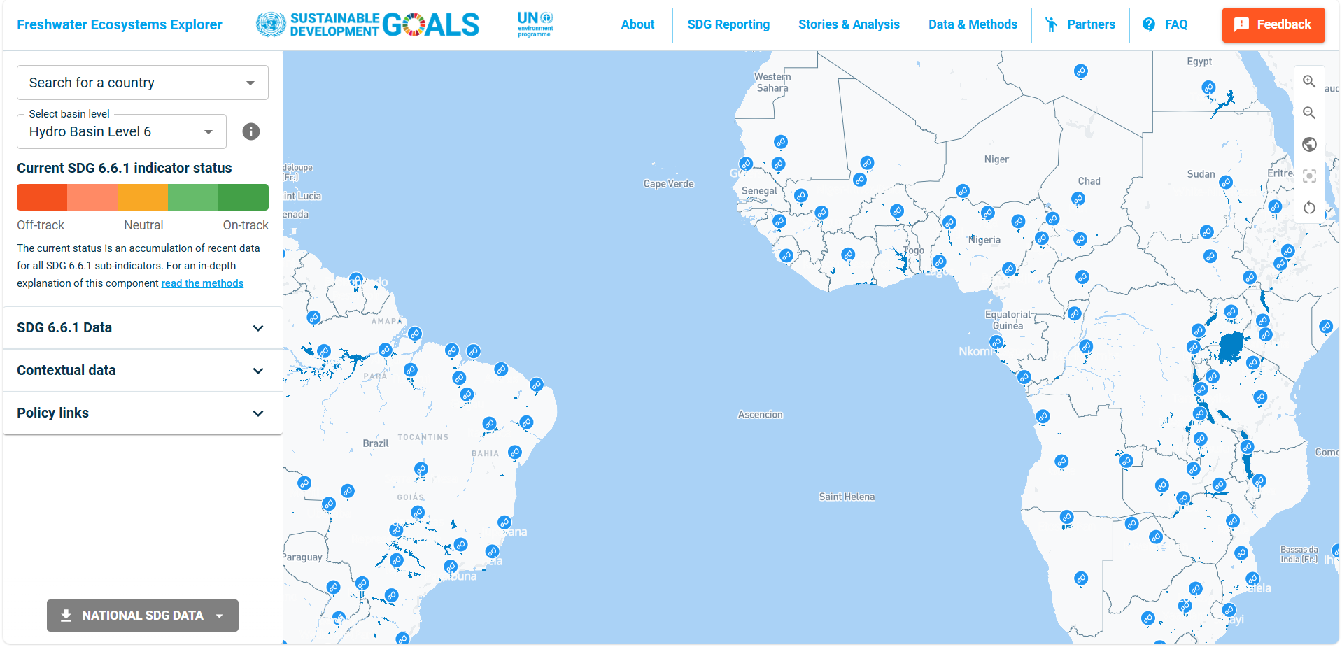
The Freshwater Ecosystems Explorer (FreshExplorer) is an online geospatial platform that provides time-series data on the extent and condition of freshwater ecosystems aligned with SDG indicator 6.6.1. It offers maps, summary statistics and downloadable datasets at national, sub-national and basin levels. Finance professionals may find it useful for assessing water-related physical risks, informing ESG analysis, and understanding long-term environmental trends affecting assets and markets. The tool is free to use and is updated regularly with new data products and indicators.
Organisation behind the tool
The tool is developed and maintained under the United Nations Environment Programme (UNEP) as custodian agency for SDG indicator 6.6.1. It is implemented through the UNEP-DHI Partnership – Centre on Water and Environment, with technical inputs from partners such as Google, the European Commission’s Joint Research Centre and other data providers. The platform forms part of the broader UN system’s monitoring framework for Sustainable Development Goal 6 on water and sanitation.
What the tool does
- Provides interactive maps showing changes in the spatial extent of freshwater ecosystems (lakes, rivers, reservoirs, wetlands, mangroves and surface water) over time.
- Displays indicators consistent with SDG 6.6.1 methodology, including permanent and seasonal surface water, water transition classes and wetland area.
- Allows users to view data aggregated at country, sub-national administrative units and river basin or sub-basin levels.
- Offers data downloads in formats such as GeoTIFF, CSV and shapefiles for further analysis and integration into other systems.
- Includes a surface water viewer, data products pages, and methodological documentation, enabling users to understand definitions, sources and limitations.
- Provides annual and multi-year statistics, including annual averages and five-year averages, to support trend analysis.
Target audience
The primary intended users are national governments and line ministries responsible for water, environment and SDG reporting. Other key audiences include international organisations, basin authorities, researchers, NGOs and development partners working on freshwater management and ecosystem protection. The platform is also accessible to the wider public, including businesses and financial institutions seeking contextual water and ecosystem information.
Relevance to finance professionals
- Risk assessment – supports analysis of physical risk where changing water extent, reservoir trends, wetland loss or mangrove degradation may affect infrastructure, agriculture, real estate or supply chains.
- ESG analysis – provides spatially explicit environmental indicators relevant to water and biodiversity pillars of ESG frameworks, including for portfolio footprinting and location-specific screening.
- Market and commodity insights – helps contextualise exposure of water-intensive sectors (e.g. agriculture, mining, hydropower) to changing freshwater availability and ecosystem condition at basin level.
- Investment context – informs scenario analysis and long-term strategic planning by linking investments to SDG 6.6 trends, national progress and potential policy or regulatory responses on water and ecosystem conservation.

